
Close calls in the Arctic Circle
Dempster Highway, Northwest Territories
Day: 78
Km travelled: 13,235
Recoveries: 1
If you want to reach the top of the world, you have two options.
Both are long drives with only a handful of service stations along the way, making each one an adventure… especially if something goes wrong.
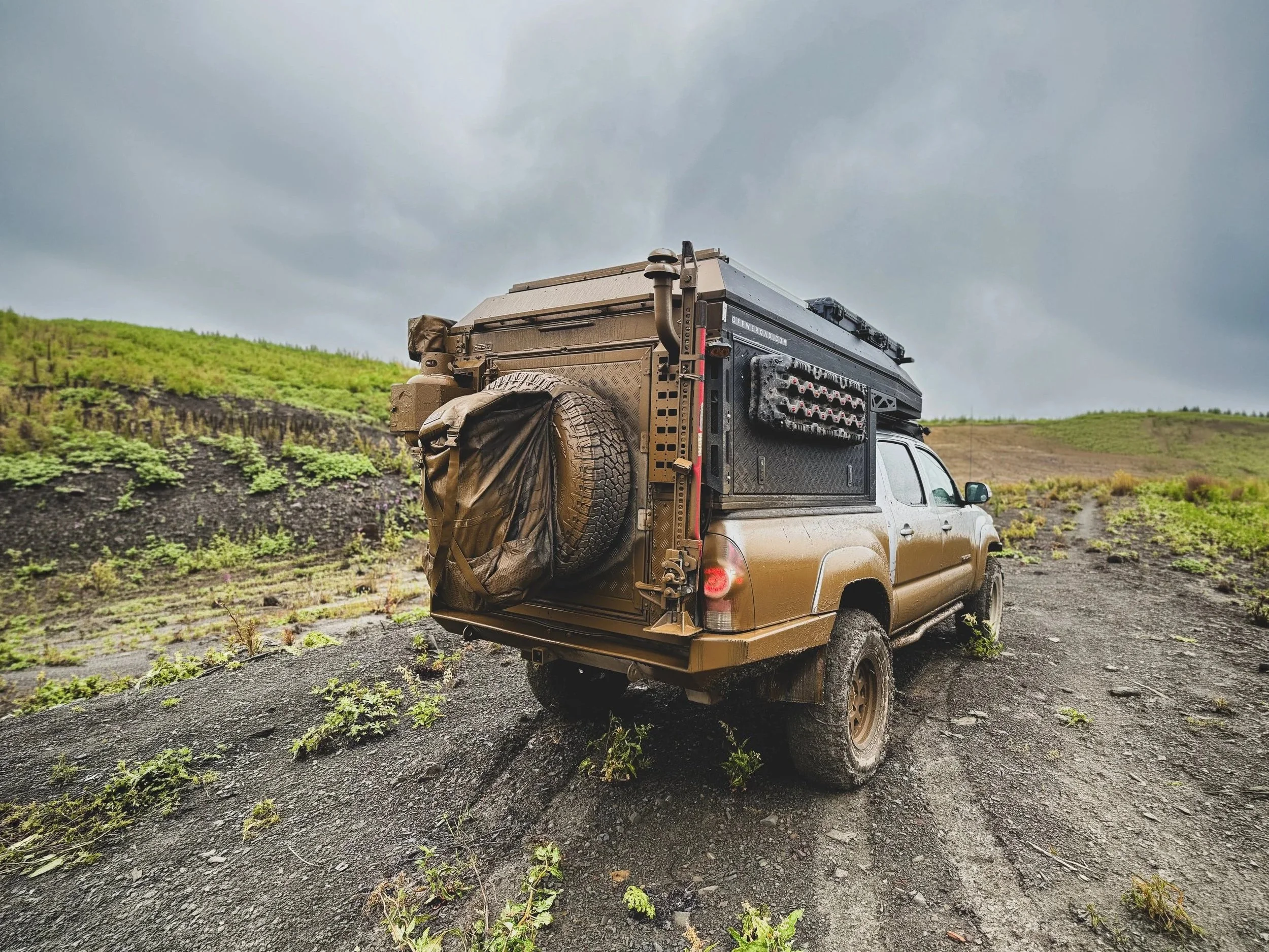
In Alaska, the Dalton Highway takes you to the Arctic Circle via Prudhoe Bay, though the start of the Alaskan Pipeline there means the ocean itself is largely off-limits to tourists. Tom and I would have loved to reach the top on that side too, especially since we'd already seen the pipeline's other end in Valdez, but Americans and Canadians alike told us the Canadian route was the better trip. So we chose the Dempster Highway: 880km of dirt road starting just west of Dawson and ending in the hamlet of Tuktoyaktuk, Northwest Territories.
"It's about the journey, not the destination" fits the Dempster perfectly. The drive runs on a little longer than it needs to, and the end point is underwhelming, but the road itself is magic, and it never stops changing.
The first 100km cuts through Tombstone Territorial Park: winding rivers, rolling hills, bigger peaks behind them, and hiking trails worth the stop if you have the time (we're headed back next week with friends, so we didn't linger). At km 82 you cross the continental divide, the point where every river behind you flows to the Pacific and every river ahead flows to the Arctic. It was our first real sense that we were actually on our way north.
From there the land just keeps opening up. The valleys widen into flatter, treeless tundra, the hills retreat toward the horizon, and big looping rivers take over the view. We crossed this stretch under low cloud, fog sitting a few hundred feet off the ground and swallowing every mountain down to its ankles. It felt empty and a little lonely, though caribou, grizzlies, and moose all move through here.
By km 200 the valley narrows again along the Ogilvie River, then the road climbs a long ridge of boreal forest with views for what feels like hundreds of kilometres in every direction: grey-spired mountains on one side, endless rolling tundra on the other. The trees here are stunted due to the acidic tundra soil and a layer of permafrost lingering underground. Heaps of berries, wildflowers, and other small shrubs still thrive on the surface, but the deciduous trees themselves look almost like something out of a Dr. Seuss book, with bulbous tops and skinny, Frankenstein-esque trunks. Because there's nothing to block the view, you can watch the road itself unspool for miles ahead, rising and falling over the hills long before you get there.
Km 400 to 475 might be the most beautiful stretch of all: the valley opens into lush green tundra that ripples like the wake of a boat frozen across an ocean of hills. Somewhere out there, tens of thousands of caribou are making their migration, and somehow, even in a landscape with nothing to hide behind, almost no one ever sees them.
At km 465 you cross into the Northwest Territories and descend to the Peel River ferry. We got lucky and barely waited. Friends who came through a few weeks earlier weren't so fortunate because the ferry's cable snapped and sent the boat drifting downriver, stranding travelers for four days.
After a second ferry crossing at the Mackenzie River, the road straightens out completely: 30km without a single bend. Doesn't sound like much until you're doing 60km/h and realize you haven't moved the steering wheel in half an hour. Coming from the mountains of B.C., that's an anomaly!
Two hours short of the Arctic Ocean is Inuvik. A town of just over 3,000 people, 700km up a dirt road with little to no other civilization along the way. For its size, Inuvik is remarkably self-sufficient, with schools, a hospital, a radio station, garages, a grocery store, a pub, and even a bike shop run out of someone's front yard.
Tuktoyaktuk is a different story. It's a coastal hamlet of about 900 people, mostly Inuvialuit, sitting right at the edge of the continent on the Arctic coast. Until 2017 it was cut off from the highway system entirely, reachable only by air in summer and by ice road in winter. The Inuvik–Tuktoyaktuk Highway is the first road in Canadian history to connect the country's road network to the Arctic Ocean. Even so, the town is run-down and a little forlorn. The only locals we saw were out on the tundra just outside town, foraging for aqpik, an orange, raspberry-like fruit that grows low across the ground up here.
We'd planned to jump in the sea the next morning, so we held off taking a dip the evening we arrived. To our delight, we woke at 4:30am to the camper shaking in what turned out to be gale-force wind, the strongest I've ever felt. We lay there wide awake, half-convinced the tent was about to leave without us. By 8am every other vehicle in the lot had cleared out except ours, and the wind still hadn't let up. With the place to ourselves, Tom and I stripped down and jumped into the Arctic Ocean to celebrate reaching the top of the world.
The thing about long roads that lead to remote places is they are not often a loop. On the Dempster, you have to drive the same 880km back the way you came. Makes you wonder about the sanity of the cyclists we passed along the way. At 100km a day, that's upwards of three weeks on this road. And yes, people bike the Dempster. I got up early one more morning and set off half an hour before Tom and Envy to run a stretch of the highway. I later discovered that no one has officially recorded running the length of the Dempster, at least that I can find in my brief google search. I'm not volunteering, but it would be a stunning accomplishment.
An out-and-back always looks a little different in reverse, and this one especially so.
About halfway through the drive back, we spotted a car in the ditch. Since the highway is built up on a raised bed of gravel, maybe ten feet above the surrounding tundra, the ditches are rather steep. A young guy named Nick, from Pennsylvania, had lost concentration for a second in the rain, drifted off the shoulder, and couldn't correct in time. He'd spent the night sleeping in his car, and that's where we found him the next morning.
We got the winch and recovery gear out, and with a couple of other travellers who'd stopped to help, spent about two hours working the car free. Nick drove off toward Inuvik without a scratch on him, though the same can't be said for his soccer-mom car. It was the first time we'd used our recovery gear for anyone, ourselves included, and there was something genuinely satisfying about finally putting it to good use. For those of you who know Tom well, you can imagine how excited he was to problem-solve and use all his gear. With a heart of gold, that man will gladly set aside a whole day to help someone in need.
In places this remote, where the nearest help might be hundreds of kilometres and a broken ferry cable away, people just stop. No one asks if you're a local or a tourist, or how long it'll take, they just get out of the car and start problem-solving with you. The Dempster is proof that the harder a place is to survive in, the more its people look out for each other. We, along with the fellas who stopped to help us, showed up as strangers to Nick, and left as the reason he still made it to Inuvik that day.
As far as animal encounters go: a mother moose with two calves trotted across the road just south of Tuk, and later, over lunch, we watched a family of mountain goats picking their way along a cliffside, quietly munching on shrubs, oblivious to the drop below. The swarms of mosquitoes we'd been forewarned never materialized…we only got a few nibbles the whole trip.
Five days, 1,760km, and the right mix of ups and downs, storm and sunshine. That, more than the ocean at the end, is what I'll remember about the Dempster.
